There's Gold In Them Hills, Or Maybe Not

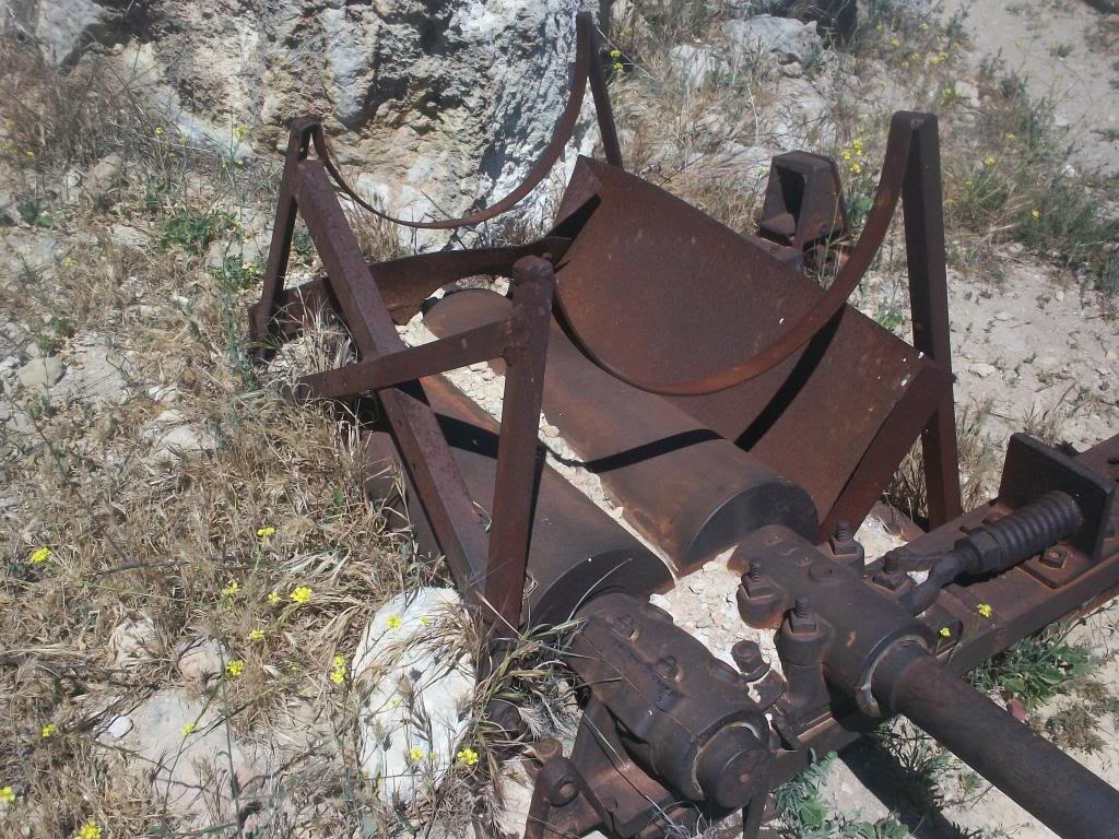
Decided to do a little mountain biking in the hills, as well as get some pics of some abandoned stuff.

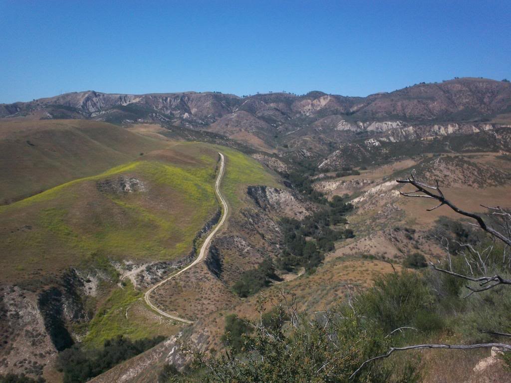
Heading out, a nice fire road to start off
4a1_zps5a887bde.jpg


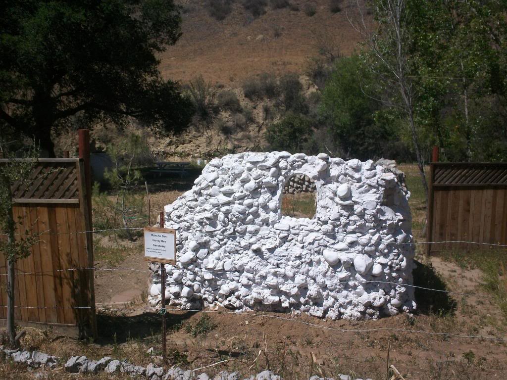
A photo of the bee sanctuary, had everything but bees, guess they were out and about
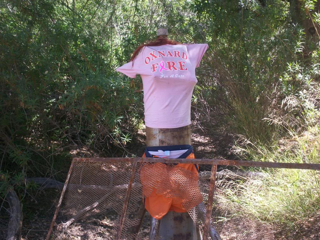
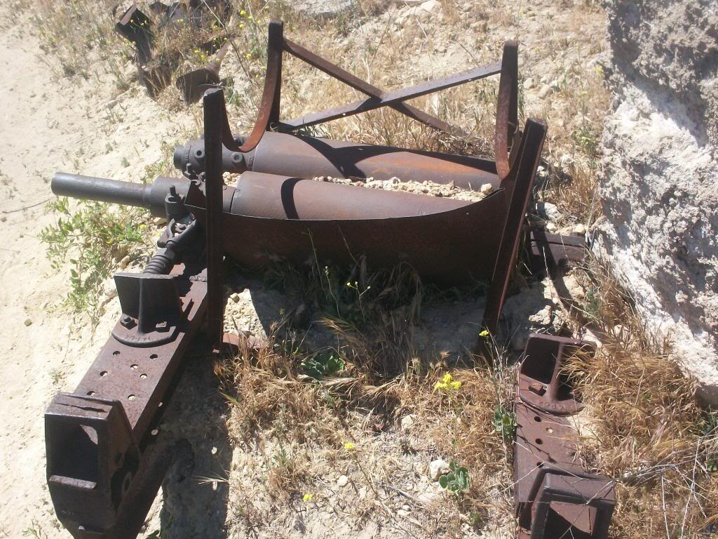
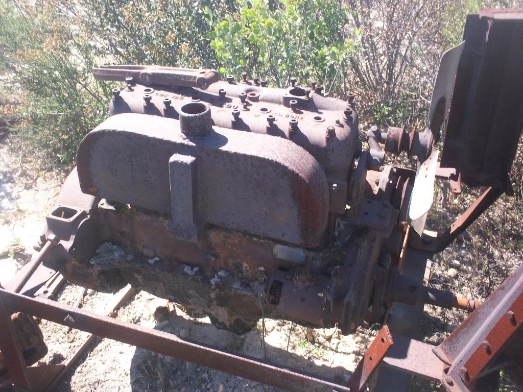
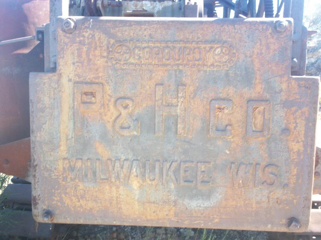
4a2_zps48dddea9.jpg


Hmmm
4a3_zpsa87fe15a.jpg


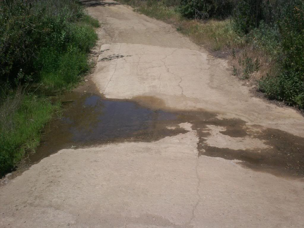
Crossing a raging So Cal river
4a4_zpsc5fcd7ec.jpg


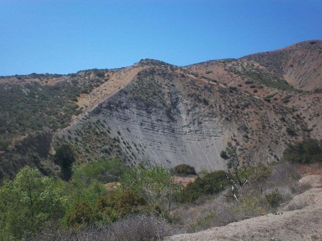
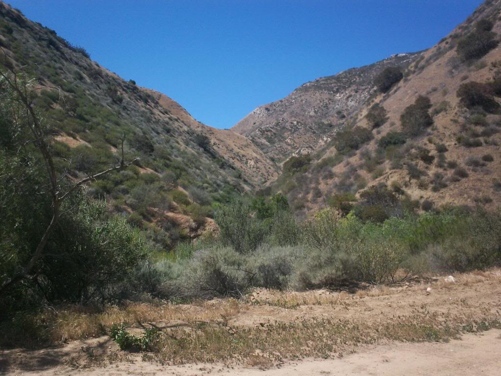
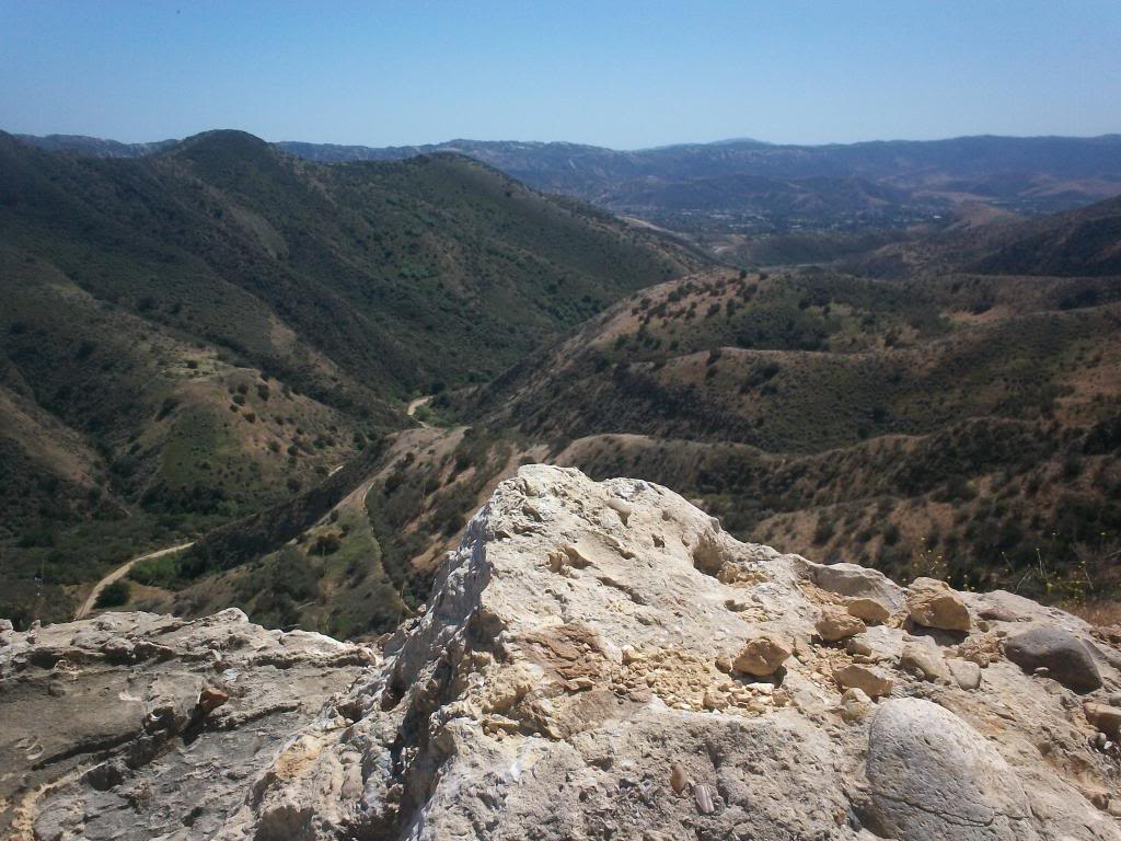
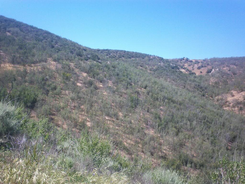
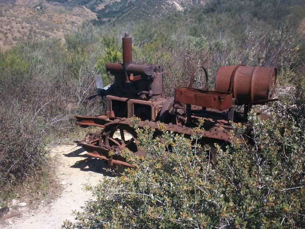
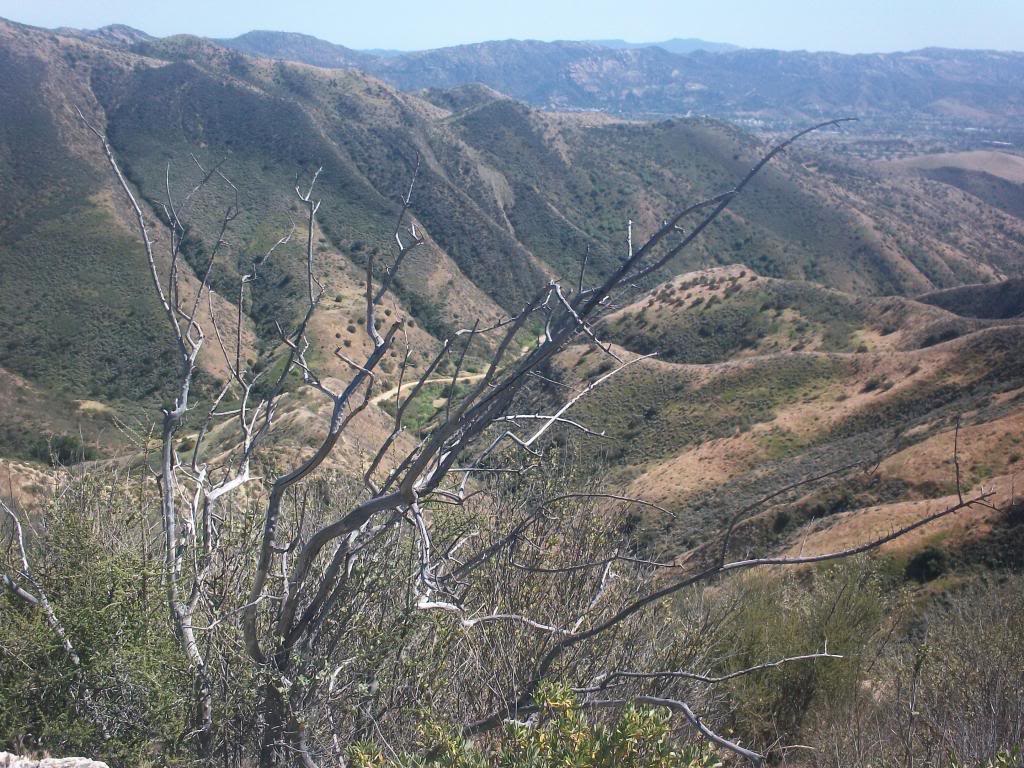
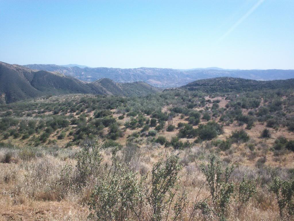
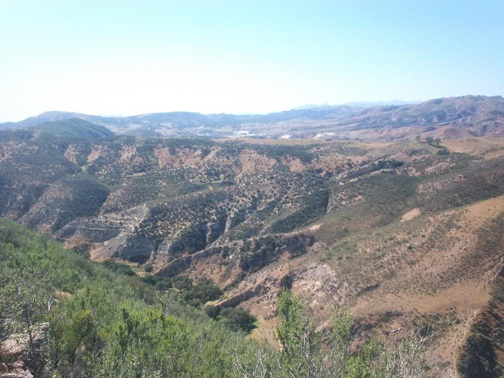
Up top is the destination
4a5_zpsb2d89834.jpg


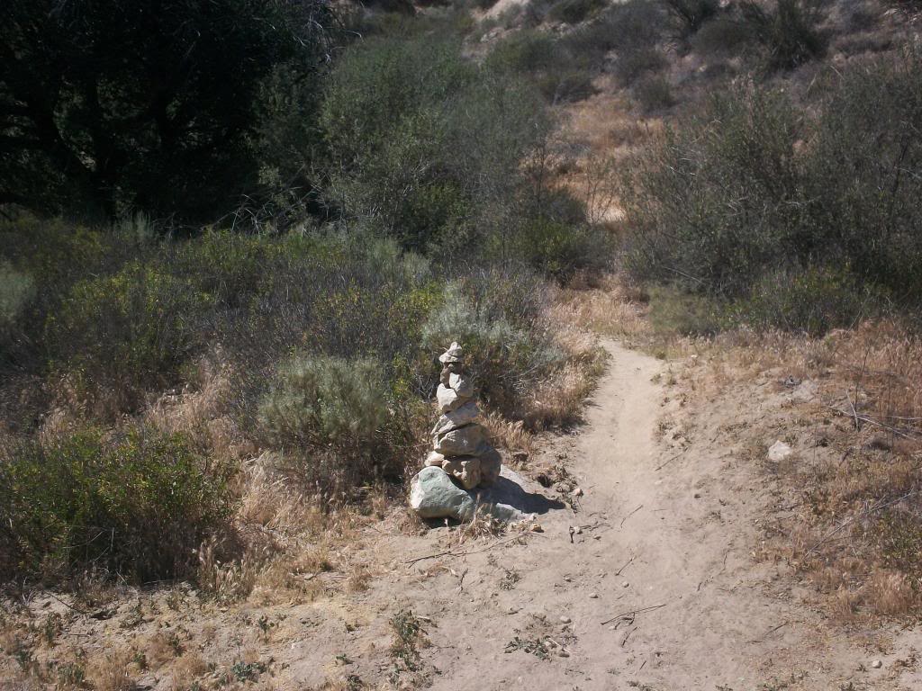
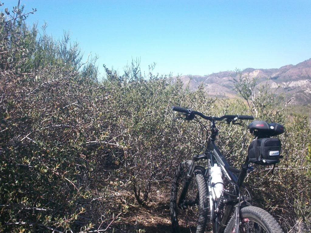
The entrance, no more easy fire road
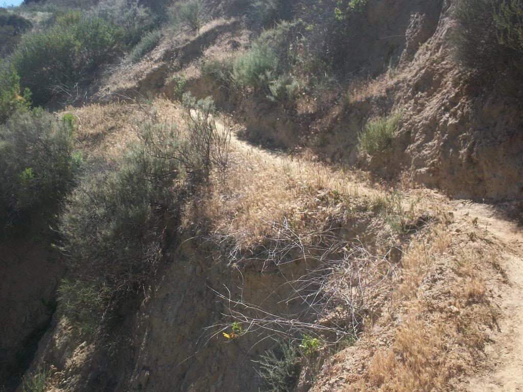
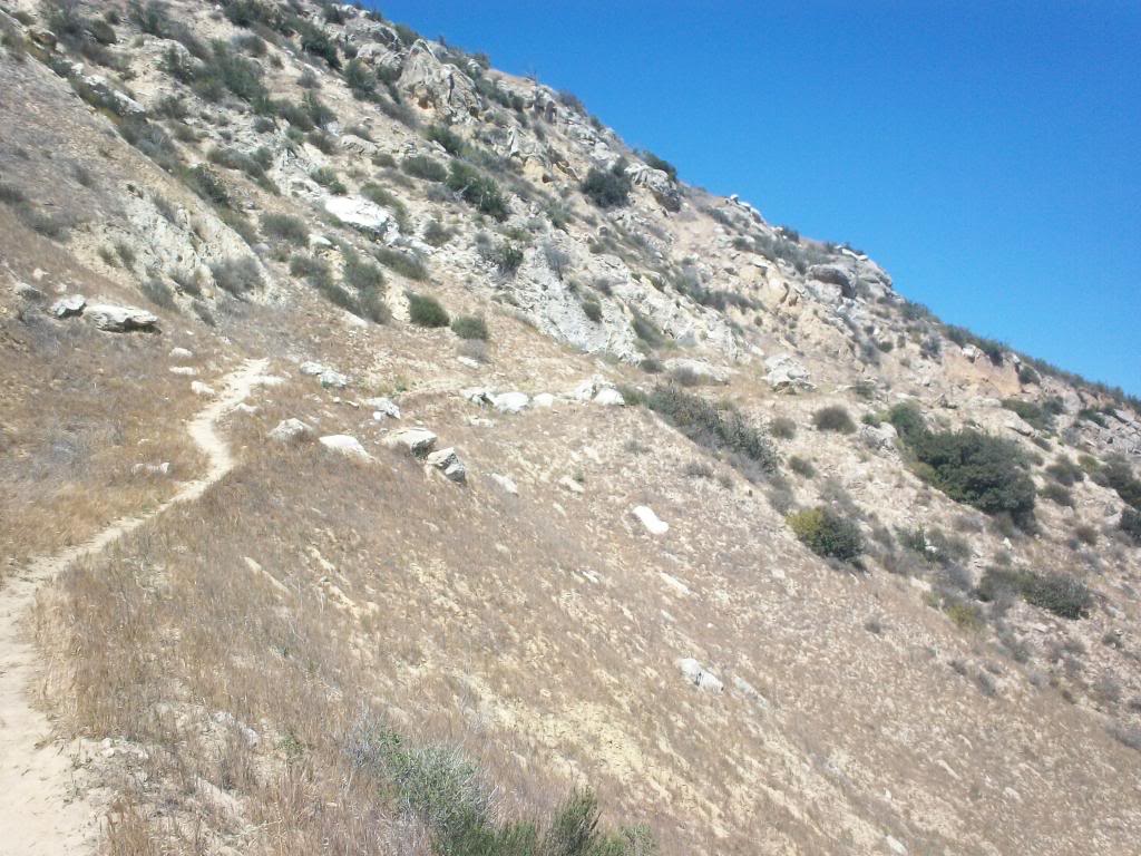
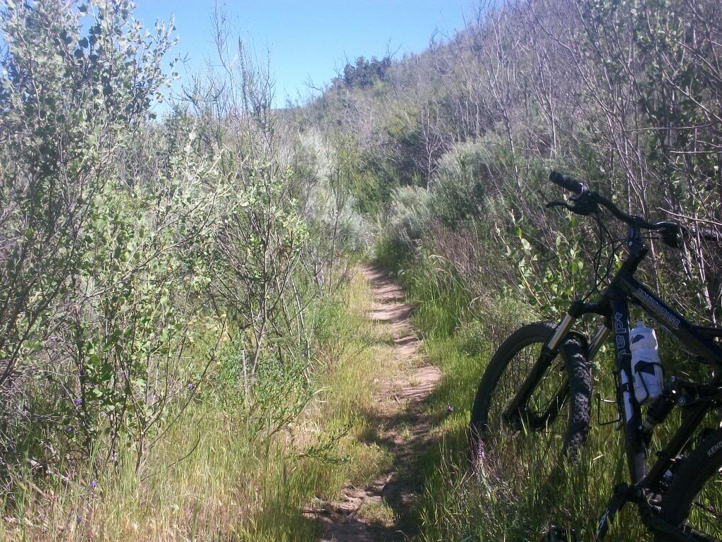
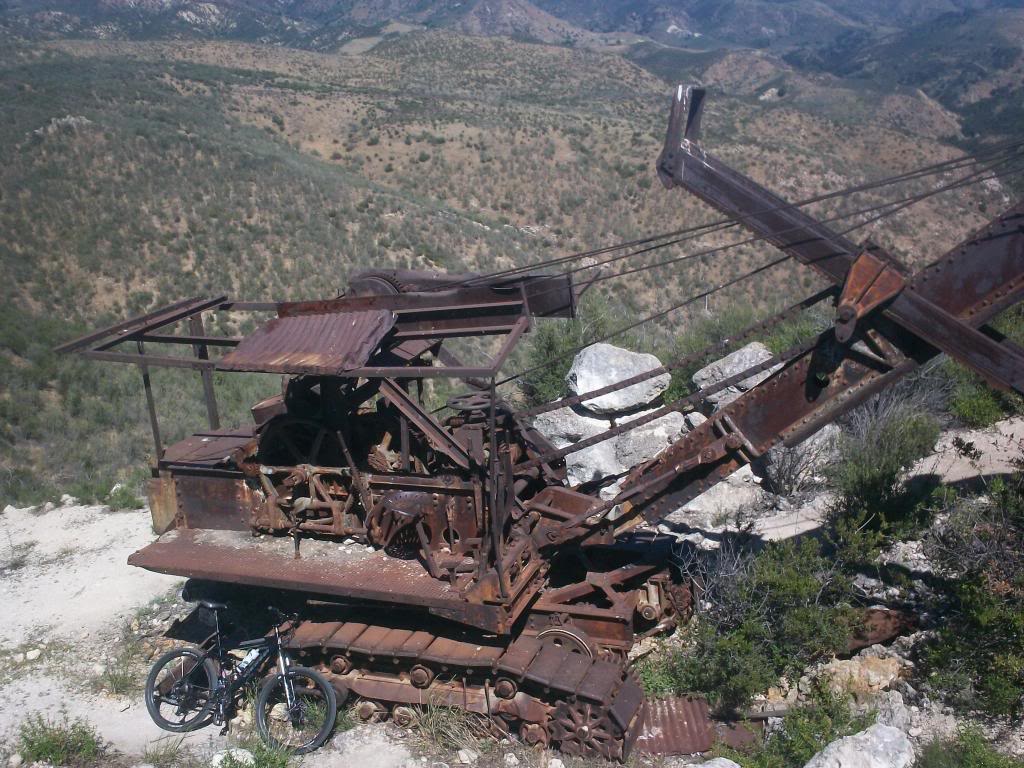
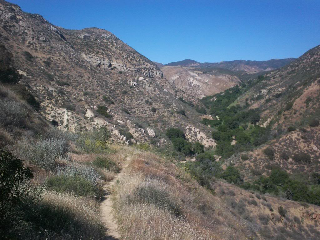
4a6_zps8cd88ef1.jpg


Heading up
4a7_zps99f2f0c8.jpg

4a9_zps78611c58.jpg

4a10_zps7eb1d7ee.jpg


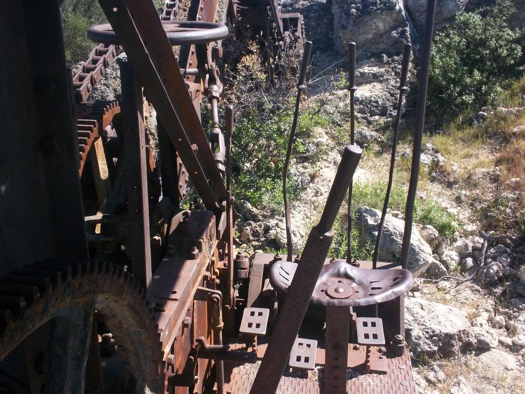
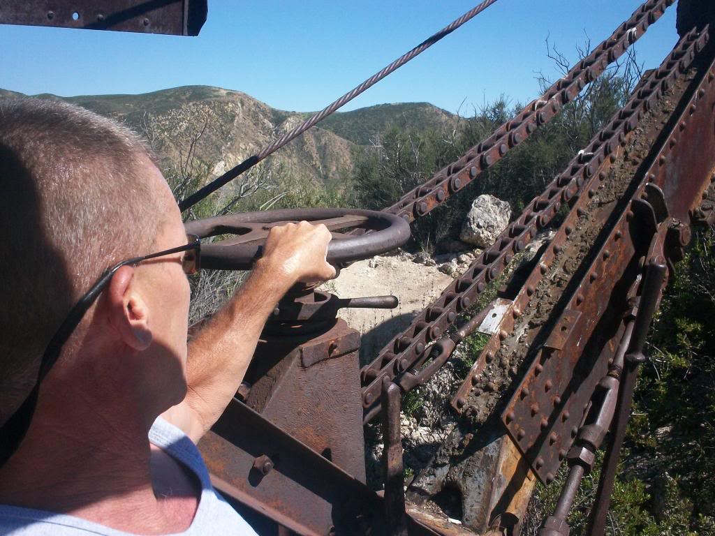
This outcrop is pretty high up
4a15_zps9756ae50.jpg


Reason I say that is because of these cool fossils of seashells in the outcrop
4a11_zps636114b4.jpg


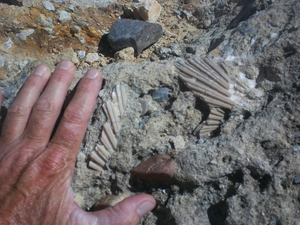
This is interesting to this story because if my amateur geology is correct, this is sedimentary rock, pretty much everything around here is sedimentary rock, I don't think this is what you are looking for if you are a gold prospector.
 
The first piece of machinery, I am guessing a crusher, kind of a mini version of a stamp mill, what do you think?
4a12_zpsdb19e947.jpg

4a14_zps647c7095.jpg

4a13_zps1164580e.jpg


Heading even higher
4a16_zpsa6d3c4ed.jpg


Getting a little green up here
4a17_zps9f91f5d5.jpg


Second stop, a little tractor and an engine on a stand
4a18_zpsc39e7466.jpg

4a20_zps99815d63.jpg

4a19_zpsc372959d.jpg


Heading up higher, almost at the top, there is this bad boy
4a21_zpsbce7ab7b.jpg

4a22_zps88f60988.jpg

4a24_zps93692071.jpg


This thing is way up there, two shots from the same place, 180 degrees apart
4a23_zps377c1cf2.jpg

4a25_zps34f7f0b4.jpg
 
I've driven front end loaders, and 18 wheelers, not sure how long I would have lasted operating this thing. No air, heat - other than the sun blazing down, no power anything, just solid steel.
4a26_zps53d1a302.jpg

4a27_zpse3473c13.jpg


Builders plate on the back, anyone know anything about this bucket, especially when it might have been built?
4a28_zps5c537972.jpg


I am guessing this was a small gold mining prospect that went bust. Not exactly a hot spot for gold mining, not sure what else they could have been looking for.
The ridge top wasn't too far from the equipment, decided to try to get there. been a few years since a wildfire has gone through here, so the going got a little tough
4a29_zps7d19cb3b.jpg


The ridge line, as well as some views of a canyon I haven't checked out yet. Not sure if it's ranch property, or gas company property, only one way to tell. Damn, it's pretty up here
4a32_zps43306969.jpg

4a30_zpsc813cbfe.jpg

4a31_zpsf77f6de4.jpg


Time to head back, downhill is a blast
4a8_zps152fc2d7.jpg


The sign of an awesome trail ride
4a33_zpsb55793ab.jpg


All in all, a fun day, with a new area to check out next ride.
 
That's my backyard. You start off of Morning Sky?
Evening Sky. Looking at Google earth, it seems that Chivo Canyon or maybe Mar Ranch will get me into that valley I was looking at from the top, have you been up either, and are they gated?
 
The first piece of machinery, I am guessing a crusher, kind of a mini version of a stamp mill, what do you think?
4a12_zpsdb19e947.jpg

4a14_zps647c7095.jpg

4a13_zps1164580e.jpg


Heading even higher
4a16_zpsa6d3c4ed.jpg


Getting a little green up here
4a17_zps9f91f5d5.jpg


Second stop, a little tractor and an engine on a stand
4a18_zpsc39e7466.jpg

4a20_zps99815d63.jpg

4a19_zpsc372959d.jpg


Heading up higher, almost at the top, there is this bad boy
4a21_zpsbce7ab7b.jpg

4a22_zps88f60988.jpg

4a24_zps93692071.jpg


This thing is way up there, two shots from the same place, 180 degrees apart
4a23_zps377c1cf2.jpg

4a25_zps34f7f0b4.jpg
Cool stuff A2... that "backhoe" looks like it was an accident waiting to happen back i nthe day... an engine behind the op, spinning wheels on both sides and cables overhead and in front...
 
Evening Sky. Looking at Google earth, it seems that Chivo Canyon or maybe Mar Ranch will get me into that valley I was looking at from the top, have you been up either, and are they gated?
No I normally drop in at Las Llayas Cyn and take it up to the "Y" and keep climbing up Rocky Peak. I then drop back down Chumash to the car. I know when I have been riding down Rocky Peak, there is a single track that drops off the side and I believe it takes you down to Topanga.

Next time you're into an adventure up that way let me know and I'll see if I can meet you and tag along.

By "the wye" I am guessing you are talking about by the windmill, left fork to the ranch, right up the hill, past the oil tanks? That hill kills me, can only do it in cool temps, and could really use an oxygen tank at the top. Next to the concrete water cistern at the top is a fossil bed with thousands of shells, they are everywhere. I believe the trail to Topanga you mentioned is Johnson Motorway, it's really fun (but overgrown towards the bottom), halfway down is the remains of a house with fantastic views. The trail ends in the exclusive gated community by the 118. The trail has an easement through the community, they don't advertise it, but if you go to the guard gate off Iverson and say you are biking the trail, they have to let you in.
A ride sounds good, but you will spend a lot of time waiting for me to catch up....

This sounds familiar...... :smirk:
 
By "the wye" I am guessing you are talking about by the windmill, left fork to the ranch, right up the hill, past the oil tanks? That hill kills me, can only do it in cool temps, and could really use an oxygen tank at the top. Next to the concrete water cistern at the top is a fossil bed with thousands of shells, they are everywhere. I believe the trail to Topanga you mentioned is Johnson Motorway, it's really fun (but overgrown towards the bottom), halfway down is the remains of a house with fantastic views. The trail ends in the exclusive gated community by the 118. The trail has an easement through the community, they don't advertise it, but if you go to the guard gate off Iverson and say you are biking the trail, they have to let you in.
A ride sounds good, but you will spend a lot of time waiting for me to catch up....
Yeah that is the climb. It is brutal and a long one at that. I have not done this trail you took pictures of, but now I am curious, so it looks like I may have to venture up that way in the next week or two and check it out. I think if I am correct, the single track you climbed, is right by the bee habitat and the Firemen dude/chick thing in the creek?

You will be surprised at how much we probably would be waiting for each other.
Check that, it is passed the second creek crossing and then up that little incline and trail head is on the left. I need to go check it out now. Looks like the trail dies out on top by the big tracktor machine dealio, but you can kind of make out where it looks like it can go. I need to go exploring now....:ride: 
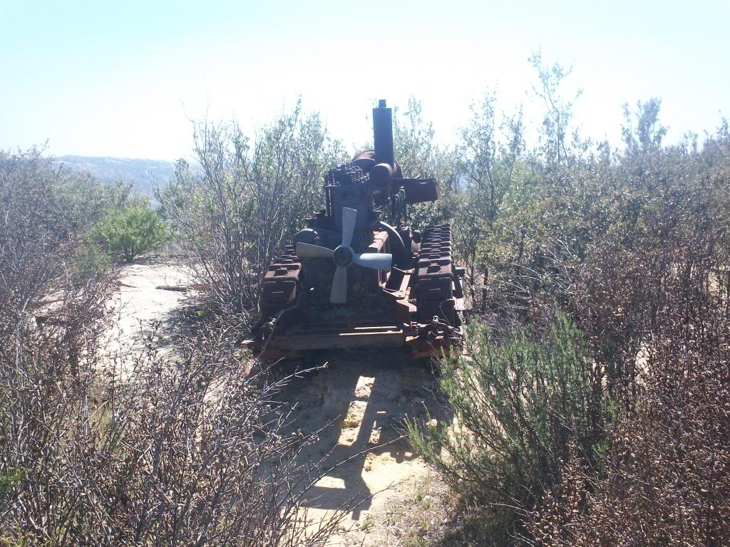
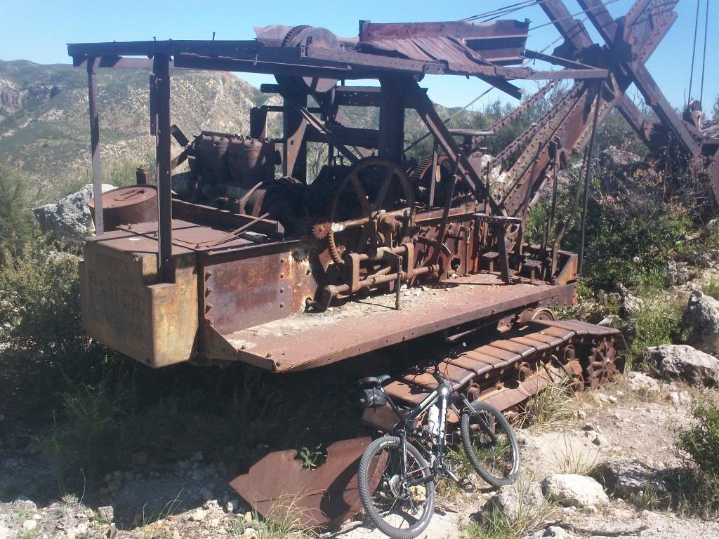
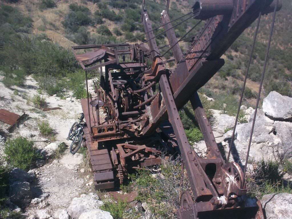
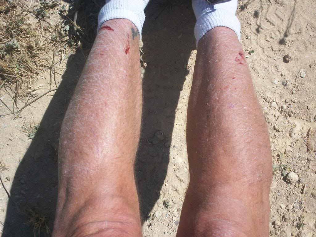
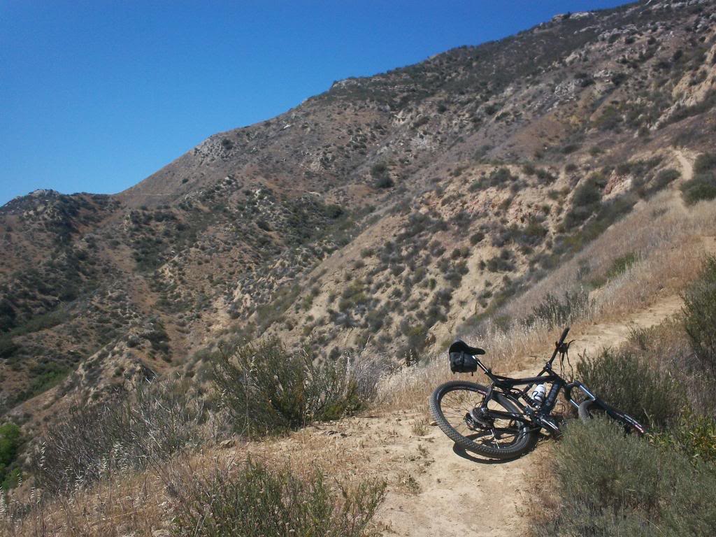
Where are those electric MX bikes when you need one.:devil:
 
Top