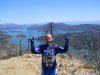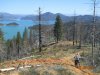
Lake Shasta! Epic Views! Great Soil! Awesome Beer!

I started my day with a little farm road dual sport 30 miles to meet up with friends and then load up to head out to Chappie Ohv Park located around Lake Shasta. Had some fun on the way to meet up at friends house with about a 60 foot across 2ft deep and flowing river. I figured I was good to go and went for it. Well let's just say I did not dump the bike but I was soaked from waist down before I even started the real ride. LoL, could have kept a pet gold fish in my boots after that.


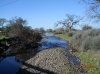
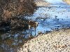
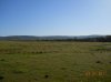
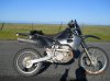
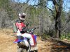
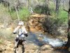
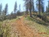
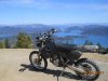
Here are some shots on the way to meet up with the group.
DSCN0427.jpg DSCN0428.jpg DSCN0429.jpg DSCN0430.jpg DSCN0431.jpg DSCN0433.jpg DSCN0432.jpg

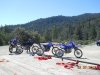
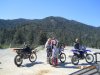
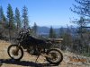
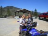
We arrive at Copely Staging area at Chappie and unload the beasts for a day of bafoonery.
The first pic here is Mt. Shasta completely covered in snow!
DSCN0435.jpg DSCN0437.jpg DSCN0434.jpg DSCN0436.jpg DSCN0440.jpg

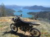
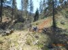
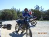
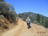
And now it's time to ride! Perfect 75 degrees with a 3mph breeze from the southwest and not a sole around. I had my own safety meeting and led the pack off into the mountains.
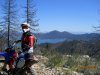
DSCN0438.jpg DSCN0441.jpg DSCN0443.jpg DSCN0442.jpg DSCN0445.jpg DSCN0446.jpg DSCN0444.jpg

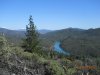
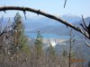
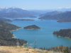
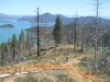
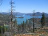
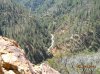
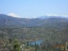
Notice in the last pic how full the lake is and the fact that they are releasing water.


Much more to follow.......
 
Sound like a fun adventure as usual. :thumb: I miss Norcal riding, can't wait for the snow to melt.
But I sure as hell don't miss not making cabbage. :smirk:
 
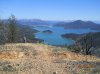
Here are some of the first great views of the ride of the Lake full! So sexy! I love that lake.

DSCN0458.jpg DSCN0457.jpg DSCN0456.jpg DSCN0455.jpg DSCN0453.jpg

DSCN0462.jpg DSCN0460.jpg DSCN0474.jpg DSCN0478.jpg DSCN0477.jpg DSCN0479.jpg DSCN0464.jpg DSCN0466.jpg DSCN0471.jpg DSCN0475.jpg DSCN0461.jpg DSCN0469.jpg DSCN0463.jpg DSCN0465.jpg

Found a new trail that goes down to the lake and cuts off about 8 miles of fire road. We were stoked. Then the next part is where some of my favorite parts of the day were. Some good waterfall crossing and such ahead....

pencil.png
 

Attachments

  • DSCN0447.jpg
    DSCN0447.jpg
    102.4 KB · Views: 133
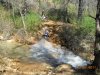
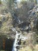
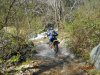
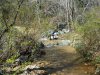
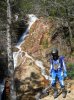
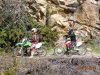
Alright here's where we get into the fun loop and some neat waterfall creek crossings and such. It was very cool!

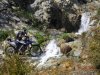
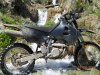
DSCN0501.jpg DSCN0492.jpg DSCN0480.jpg DSCN0481.jpg DSCN0483.jpg DSCN0485.jpg DSCN0486.jpg DSCN0487.jpg DSCN0488.jpg DSCN0490.jpg DSCN0496.jpg DSCN0494.jpg DSCN0495.jpg DSCN0493.jpg DSCN0500.jpg DSCN0491.jpg

And that for the most part concluded the days riding. We ended with Blue Moon Honey Ale, Sierra Nevada Tumbler and some snacks to tide us over until dinner where we had grilled Elk tenderloin, Ceasar salad, fresh bread, and more beer. What an awesome day.
pencil.png
 

Attachments

  • DSCN0489.jpg
    DSCN0489.jpg
    106.1 KB · Views: 121
  • DSCN0484.jpg
    DSCN0484.jpg
    102.8 KB · Views: 125
  • DSCN0482.jpg
    DSCN0482.jpg
    104.7 KB · Views: 122
WOW! I have never seen that lake so full! I did a houseboat trip there years ago and it was waaaay low. I drove arcoss it with my bikes on my way up to WA. 2 years ago and it was low then. I need to check that area out! SO pretty! The riding looks pretty decent too!

Great pics and report. Thanks:thumb:
 
Great looking ride day RM! :thumb:

I notice a lot of you left coasters have GPS's, are the riding areas that extensive that it requires on in case of emergency or can you get away with a trail map just as easy? I've done some all day rides here in NJ back when we had trails and stuff but civilization was never far off... just a left and a right dumped you out by a gas station or a familiar place. Would the trails there be marked well or is it hit and miss when it comes to figuring out where you are?
 
Great looking ride day RM! :thumb:

I notice a lot of you left coasters have GPS's, are the riding areas that extensive that it requires on in case of emergency or can you get away with a trail map just as easy? I've done some all day rides here in NJ back when we had trails and stuff but civilization was never far off... just a left and a right dumped you out by a gas station or a familiar place. Would the trails there be marked well or is it hit and miss when it comes to figuring out where you are?

Yes, some areas can be very large with little in the way of signage. In the desert you can literally ride for hundreds of miles. It's been a few years since I've ridden Chappie (where this ride report is from) but I remember it having adequate signage for my trail map following skills.

The best navigation device is your brain. I carry a GPS, but so far I have only used it once to find myself. It was during a night desert ride.
 
GPS is mainly for backup and for tracking new trails in new areas. Otherwise I use it as an oh shit device. There are also many times where I will be about 60 miles or more from anyone or anything and if the road I am on is washed out or something, I can use it to find alternate routes without running out of gas.
 
Great pictures. I was up to Shasta a couple of years ago as a friend of mine lives up there, Round Mountain to be exact. The water was waaaaay down then. Sure is good to see it filled up again.
 
Top